Global Navigation Satellite Systems (GNSS) have become an integral part of modern life, enabling everything from smartphone maps to precision agriculture and autonomous vehicles. But what exactly powers this technology? Understanding the science behind GNSS navigation: satellites, signals, and solutions reveals the complex, yet fascinating mechanisms that allow us to pinpoint locations anywhere on Earth with remarkable accuracy.
What is GNSS?
GNSS stands for Global Navigation Satellite System, a collective term for satellite constellations that provide geospatial positioning with global coverage. The most widely known GNSS is the U.S. Global Positioning System (GPS), but other major systems include Russia’s GLONASS, Europe’s Galileo, and China’s BeiDou.
The Role of Satellites in GNSS
At the heart of GNSS navigation are dozens of satellites orbiting the Earth at high altitudes. These satellites continuously broadcast signals containing their precise location and the exact time the signals are sent. By receiving signals from multiple satellites simultaneously, GNSS receivers on the ground can calculate their own position through a process called trilateration.
- Satellite Constellations: Each GNSS system operates a constellation of 20-30 satellites in medium Earth orbit (MEO), ensuring multiple satellites are visible from any point on Earth at any time.
- Orbital Mechanics: Satellites orbiting about 20,000 km above Earth complete two orbits per day, maintaining precise timing via atomic clocks.
The Science of GNSS Signals
The signals sent by GNSS satellites are radio waves encoded with time and orbital data. These signals must travel through the atmosphere, including the ionosphere and troposphere, which can affect their speed and accuracy.
- Signal Types: GNSS signals operate on multiple frequencies to improve accuracy and reduce interference.
- Time Synchronization: Atomic clocks onboard the satellites ensure signals carry precise timestamps, which are critical for calculating the receiver’s distance from each satellite.
- Signal Processing: Receivers analyze the timing of incoming signals to compute distance, then combine data from multiple satellites to determine exact position.
Solutions Enabled by GNSS Technology
The science behind GNSS navigation: satellites, signals, and solutions extends far beyond just finding your way on a map. This technology enables a wide array of critical applications:
- Navigation and Mapping: From driving directions to maritime route planning.
- Timing and Synchronization: Telecommunications, power grids, and financial systems rely on GNSS for precise timekeeping.
- Surveying and Agriculture: Precision farming techniques use GNSS for efficient land management.
- Emergency Services: Search and rescue operations depend on accurate positioning to save lives.
- Autonomous Systems: Self-driving cars and drones use GNSS as a fundamental part of their navigation systems.
Challenges and Future Developments
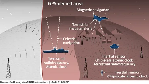
Despite its successes, GNSS technology faces challenges such as signal interference, multipath errors (reflections), and intentional jamming. Scientists and engineers are continually working on solutions like multi-frequency receivers, augmentation systems (e.g., WAAS, EGNOS), and integration with inertial navigation systems to enhance accuracy and reliability.
Conclusion
Understanding the science behind GNSS navigation: satellites, signals, and solutions illuminates the sophisticated interplay of technology that makes global positioning possible. As GNSS systems evolve, they will continue to unlock new capabilities and opportunities across diverse sectors, shaping the future of navigation and beyond.


